Oregon Road Trip
Exploring Oregon, especially Crater Lake, has been on my bucket list for some time now. I finally got to do it the end of June when I went on a road trip down the Oregon coast before driving east to Crater Lake.

I left early on a Saturday morning and drove to Cape Disappointment State Park, where I would be spending my first night. Along the way, I stopped to check out the Satsop nuclear silos which were built, but never used (the project being canceled before completion). I was really bummed that the silos are now fenced off with no trespassing signs everywhere (at one time, you could go inside and take photos). I’m sure there are still those people who don’t care about breaking the law and will climb the fence, but I’m not one of them! It’s a shame that these just sit there…I can envision them as really cool picnic shelters (you can see in the photo that they are built on “stilts” and it’s quite shady underneath).

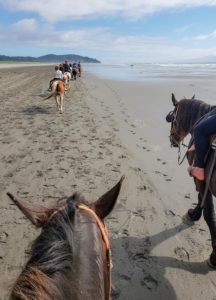
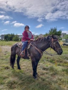
After I set up camp at Cape Disappointment, I headed into Long Beach to grab some lunch. I also wanted to see if they still offered horseback riding on the beach. I was in luck…there was one starting in 15 minutes. I had to run down the street to get cash, but made it in time. Since I’m a large gal, I got stuck with a huge draft horse (part Percheron). I would have been ok with that, but this nag only had one speed (very slow) and didn’t pay attention to my tugs on her bit reign or kicks in the side…she just wanted to be in the rear near her boyfriend (another draft horse, whose rider never rode before and didn’t have a clue). Even on the part of the beach where we could trot a little, she was having none of it…she just continued to plod along. I can usually control a horse fairly well and this was the first time I was on a horse that was so stubborn. Even still, it was nice riding on the beach.

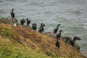
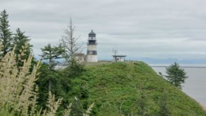
After the ride, I drove back to the state park to do some short hikes and to take photos. The first stop was at the Cape Disappointment Lighthouse. You can’t actually hike out to the lighthouse, to my knowledge, but you can get some decent shots from the learning center and down by the beach. There was a strong smell of guano (bird poop), which told me there were lots of shore birds, like cormorants, on the rocks below where I was taking photos.

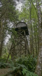
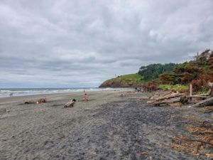
My next stop was a short hike to both the Bell’s Overlook and the North Head Lighthouse. While hiking to Bell’s Overlook, I noticed a lot of ripe salmon berries, so I had a tasty snack along the trail. I also discovered an old water tower and an old bunker. The only think I didn’t like about this trail was that it didn’t connect to the trail to the lighthouse like I thought, so I had to backtrack. I made the best of it, though, and sat on a bench for a while, listening to the birds. I was able to identify a very fast flying, tiny bird using the Merlin app, then verifying it’s call with iBirdPro. It was a Wilson’s Warbler and there were dozens flitting through the trees. I even recorded one of them and uploaded it to Sound Cloud.
After an early dinner, I crawled in my tent and went to bed by 8:30pm. I slept hard, waking only once to use the bathroom and woke up at 6am.

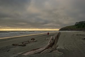
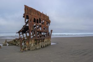
I decided not to cook breakfast and made a stop in Warrenton, OR to get gas and grab some food, before pressing on to the wreck of the Peter Iredale. The rusted steel skeleton of a ship ran ashore in 1906 & is a popular site in Fort Stevens State Park. Since I got there early, there were no kids climbing on it and I was able to get some decent photos, even though the sky was cloudy and gray.
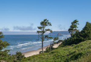
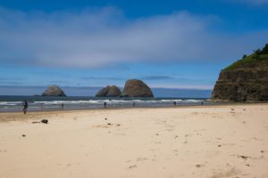
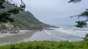
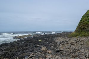
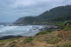
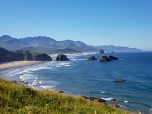
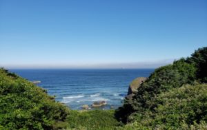
After leaving Warrenton, I drove along Hwy 101, which is a scenic byway, stopping to take photos along the way. Since the tide was in, I didn’t bother stopping at Canon Beach since it’s a long walk on the beach to get to Haystack Rock (best during low tide). Instead, I went to Ecola State Park and checked out the views.

In the afternoon, I met up with Debra, another Mountaineer member at Devil’s Lake State Recreation Area and set up camp. The campground was pretty much in the town of Lincoln City. It turned out that the town was having a kite festival, so traffic was really bad, taking a very long time to even drive one block. Debra and I decided to forego the hike at Dean Creek and battling traffic, so we stuck to the campground, walking to the lake, sitting and listening to birds, and just chatting.
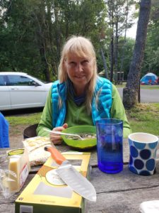
As evening approached, I asked Debra to join me for dinner. I made a recipe from the WTA’s monthly magazine. It was vegetarian, but it quite filling and tasty. It was a soup with a miso base, mushrooms, edamame, seaweed, buckwheat soba noodles and some Japanese seasonings. Here’s the recipe for Backcountry Soba.
After we ate, I noticed the sky getting dark and check my weather app. Yep, it was supposed to rain. I didn’t want to camp in a tent in the rain, then have to pack it wet this early in my trip, so I packed up everything and got a hotel room down the street. It was nice to take a shower and they had a great breakfast buffet the next morning. I was glad I got a hotel room since it rained pretty heavily during the night and most of the morning!

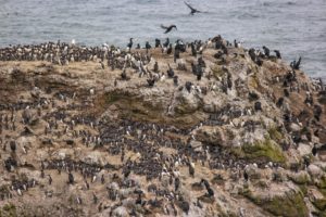
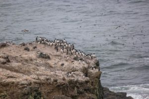
I met up with Debra at a Starbucks the morning of day three. After getting gas, we proceeded south on Hwy 101, making stops at scenic overviews and lighthouses. I really enjoyed Yaquina Head Lighthouse…not so much because of the lighthouse, but because of the rocks covered in birds that were very close. There were hundreds of Brandt’s cormorants and common murres, as well as a few western gulls. We also saw a couple of turkey vultures soaring around the rocks, looking for something dead to eat. One must have found something, because it swooped down and landed among the murres.

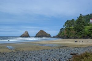
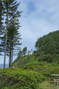
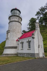
The next stop was to the Heceta Head Lighthouse. I could barely see the lighthouse on the bluff above the beach, so I walked up the half mile, slightly steep trail. At the lighthouse, volunteers were giving tours of the lighthouse. I learned some interesting things, like lighthouse beacons aren’t used to warn ships of dangerous rocks. They are used as a way for a ship to know where he’s located. Each lighthouse shines their beacon 21 miles out to sea. Each lighthouse is 40 miles apart, so their beacons pick up where the other lets off, plus each lighthouse uses a different signal, whether it’s color or time between the light shining. All this helps the ship navigate, especially when stars are blocked by clouds. Well, at least that’s how it used to be done. These days, with GPS, satellite, etc., ships don’t really need the lighthouses.
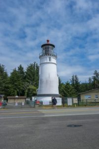
Our campground that night was at Umpqua Lighthouse State Park. It was a darling park with really big campsites and a pretty lake with a mile long loop around it (which we walked). I made camp pizza biscuits for dinner while Debra went to the Oregon Dunes to look around.
After leaving Umpqua, we headed east to our campground at Theilsen View. We lost each other in the car caravan, but I wasn’t worried since we were both camping at the same place.
My stupid GPS decided to play games with me and had me drive up some steep forest service roads. I drove white-knuckled at about 20mph, wondering where the heck it was taking me (I thought maybe it was a shortcut). Nope. When I finally had enough and was scared of being stranded in the middle of nowhere, I used another GPS app that had downloaded maps. It allowed me to get out of the mess I was in and back on the correct (paved) road. During my bumpy ride on the service road, I got to see some amazing views and managed to snag something that ripped my right rear bumper off so that it was sticking out. Oh well…that’s why I travel with duct tape!
I learned long ago that it’s wise to keep duct tape in my car. It’s come in handy quite a few times!

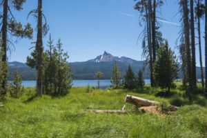
After arriving at Theilsen View, I set up camp and walk along the gorgeous lake with a craggy peak in the distance. I also got eaten alive by mosquitoes, in spite of wearing bug spray! They were biting through my clothes and the itchy was maddening.
I went to bed around 9:30pm, but had trouble falling asleep since the campers next door were up late and talking loudly. They also woke me at 5am with their loud talking. I tried to sleep a bit longer, but it was a lost cause, so I got up and made breakfast of coffee, beef jerky, then hit the road after say good-bye to Debra.
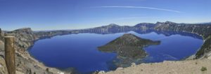
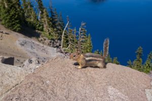
I was excited for this next part of my road trip…Crater Lake! My first view of it was absolutely breath-taking! I didn’t, however, love the crowds. I had planned to meet up with others at the Rim Cafe, but couldn’t find parking. I finally found someone who was leaving, but they needed to change a diaper and make sandwiches first. I waved those behind me to go around…they weren’t happy about it, but oh well.
I never did meet up with the others. Cell service was very spotty or non-existent. So, I ended up alone at Crater Lake. It was really hot, so I didn’t feel like hiking anywhere…plus, there were too many people.
Since everyone else had bailed on the rest of the road trip, I decided to push on past my next camping location and got a hotel in Bend.
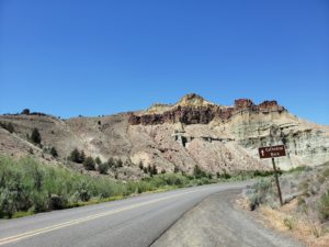
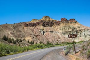
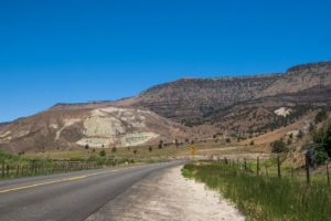
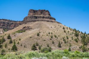
On my last day of my road trip, I intended to drive to the Painted Hills, but between the heat, long stretches with no place to pee (my Go Girl wasn’t as easy to use when my pants didn’t have a fly and I had to go too bad to take my time and adjust) and long stretches of road work, making driving speed slow, I ended up just skirting the Painted Hills before calling it good and heading home. I got as far as Yakima, WA, before getting a hotel room for the night. The drive from there the next day is one I’ve done often, so I knew what to expect.






2 Replies to “Oregon Road Trip”
As a 58 year Oregonian since birth I loved your story.
I have a donation based hostel just 9 miles from the Painted Hills. Two tips, there is a bathroom, info kiosk, water fountain and shaded picnic area, wifi and a ranger, just south of the Painted Hills entrance at the Y.
Second tip, Mitchell is just 9 miles east on Highway 26. We have gas, lodging, general store, post office, cafes and our own Tiger Town brewery. If you ever need a potty stop Mitchell has a city park with flushing and clean potties, RV parking and camping. I always encourage folks to stop at the hostel for free wifi, potty, free coffee, direction or route suggestions by hike, bike or car.
So pleased to read your adventure, it was enjoyed.
Thanks for the info! I may be going to John Day in March 2020, but it’s still up in the air at this point.